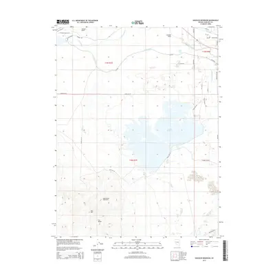
2014 Map of Sheckler Reservoir
USGS Topo · Published 2014About this map
The Dead Camel Mountains dominate the southwestern terrain of this 2014 survey, providing a stark backdrop to the engineered water systems of the Lahontan Valley. This region is defined by the complex intersection of historical travel routes and modern irrigation, where the California Emigrant Trl and the Old Carson Hwy cross paths near the Carson River. The landscape reveals a highly managed environment centered on the Sheckler Reservoir, supported by an extensive network of artificial waterways including the V Line Canal, the N Line Canal, and the Upper W Side Drain. Notable topographic landmarks such as Red Mtn and The Nipple rise above the valley floor, while features like the Twenty Six Foot Drop indicate the elevation changes managed by the local canal system. This map documents the persistent agricultural and transit infrastructure that has shaped Churchill County's development.
Find a feature on this map
35 named features on this map. Tap any name to fly to it.
Don’t see what you’re looking for? This feature index may not catch every label — zoom into the map to look around manually.
Map Details
Editions of this 2014 Sheckler Reservoir Map
This is the sole edition of this map. No revisions or reprints were ever made.
Other maps of this area

1890 · Wadsworth
USGS Topo · 1:125,000

1891 · Wabuska
USGS Topo · 1:125,000

1892 · Wadsworth
USGS Topo · 1:125,000

1894 · Wadsworth
USGS Topo · 1:125,000

1894 · Wabuska
USGS Topo · 1:125,000

1908 · Carson Sink
USGS Topo · 1:250,000

1910 · Carson Sink
USGS Topo · 1:250,000

1951 · Soda Lake
USGS Topo · 1:62,500

1951 · Fallon
USGS Topo · 1:62,500

1957 · Two Tips
USGS Topo · 1:62,500