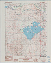
1985 Map of Sheckler Reservoir
USGS Topo · Published 1985About this map
The La Hontan Valley landscape is dominated by the sprawling waters of Sheckler Reservoir and the engineered flow of the Carson River. This mid-1980s survey documents a region defined by water management and historic transit, where the Carson Diversion Dam regulates the river near the agricultural community of Swingle Bench. The map preserves the path of the Emigrant Pioneer Trail, tracing the (Carson River Route) as it historically guided travelers through this arid corridor. To the southwest, the desert terrain rises sharply into the Dead Camel Mountains, featuring landmarks like Red Mtn and The Nipple. Infrastructure from the Southern Pacific railroad and localized mining activity, such as a Borrow Pit and various Prospects, indicates the industrial and transit footprint on the valley floor alongside family-named sites like Paul Place and the seasonal Camp Gregory.
Find a feature on this map
27 named features on this map. Tap any name to fly to it.
Don’t see what you’re looking for? This feature index may not catch every label — zoom into the map to look around manually.
Map Details
Editions of this 1985 Sheckler Reservoir Map
This is the sole edition of this map. No revisions or reprints were ever made.
Other maps of this area

1890 · Wadsworth
USGS Topo · 1:125,000

1891 · Wabuska
USGS Topo · 1:125,000

1892 · Wadsworth
USGS Topo · 1:125,000

1894 · Wadsworth
USGS Topo · 1:125,000

1894 · Wabuska
USGS Topo · 1:125,000

1908 · Carson Sink
USGS Topo · 1:250,000

1910 · Carson Sink
USGS Topo · 1:250,000

1951 · Soda Lake
USGS Topo · 1:62,500

1951 · Fallon
USGS Topo · 1:62,500

1957 · Two Tips
USGS Topo · 1:62,500