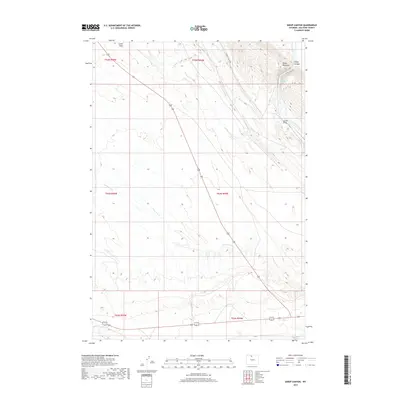
2017 Map of Sheep Canyon
USGS Topo · Published 2017About this map
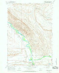
Sheep Mountain dominates the northeastern corner of this Big Horn County landscape, where the high ridges give way to the carved depths of Sheep Canyon. This arid region is defined by its drainage patterns, with the Bighorn River cutting through the far eastern edge and a network of seasonal draws and creeks marking the terrain. The presence of Sheep Mountain Springs near the canyon head suggests a vital water source in an otherwise dry environment. Historically used for grazing and transport, the area is crisscrossed by remote routes like Ribbon Canyon Rd and bordered by significant drainages including Lovell Draw and Little Dry Cr. The map illustrates a stark western landscape organized by the Public Land Survey System, showing the township and range lines that have governed Wyoming land management for over a century.
Find a feature on this map
14 named features on this map. Tap any name to fly to it.
Don’t see what you’re looking for? This feature index may not catch every label — zoom into the map to look around manually.
Map Details
Editions of this 2017 Sheep Canyon Map
This is the sole edition of this map. No revisions or reprints were ever made.
Other maps of this area

1951 · Otto
USGS Topo · 1:24,000

1955 · Cody
USGS Topo · 1:250,000

1958 · Cody
USGS Topo · 1:250,000

1962 · Cody
USGS Topo · 1:250,000
1966 · Sheep Canyon
USGS Topo · 1:24,000
1966 · Gould Butte
USGS Topo · 1:24,000

1966 · North Emblem Reservoir
USGS Topo · 1:24,000
1966 · Greybull South
USGS Topo · 1:24,000
1966 · Greybull North
USGS Topo · 1:24,000

1966 · Emblem SE
USGS Topo · 1:24,000