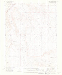
1972 Map of Sheep Canyon
USGS Topo · Published 1976About this map
Timpas Creek carves through the high plains of southern Colorado in this early 1970s survey, marking a landscape where vital water sources define human activity. The legendary Santa Fe Trail follows the creek's corridor, paralleled by the Atchison Topeka and Santa Fe railroad, illustrating the long-standing transit route through the Iron Springs Hills. The map reveal a ranching economy dependent on a network of remote water infrastructure, including family-named landmarks like Hoffman Windmill, Mullins Windmill, and Lees Windmill.
Find a feature on this map
37 named features on this map. Tap any name to fly to it.
Don’t see what you’re looking for? This feature index may not catch every label — zoom into the map to look around manually.
Map Details
Editions of this 1972 Sheep Canyon Map
4 editions found
Other maps of this area

1891 · Timpas
USGS Topo · 1:125,000

1894 · Timpas
USGS Topo · 1:125,000

1955 · La Junta
USGS Topo · 1:250,000

1958 · La Junta
USGS Topo · 1:250,000

1965 · La Junta SW
USGS Topo · 1:24,000

1968 · La Junta
USGS Topo · 1:250,000

1972 · Packers Gap
USGS Topo · 1:24,000
1972 · Stage Canyon
USGS Topo · 1:24,000
1972 · Timpas SW
USGS Topo · 1:24,000
1972 · Lockwood Arroyo
USGS Topo · 1:24,000