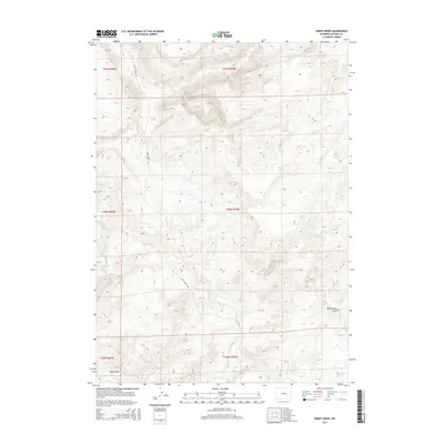
2015 Map of Sheep Creek
USGS Topo · Published 2015About this map
Bates Hole defines the southwestern corner of this Natrona County landscape, marking a transition in a terrain carved by an intricate drainage system. The area is dominated by the winding course of Bates Creek, which is fed by numerous tributaries including Corral Creek, Sheep Creek, and Kerfoot Creek. This 2015 survey reflects a high-plains environment where water sources like Indian Spring and the Mud Springs Draw are critical landmarks. Human presence is concentrated along the singular thoroughfare of Bates Creek Rd, which tracks the primary valley. The map provides a look at the land's administrative structure through its township and range divisions, showing how early 21st-century property and resource management overlay this complex network of seasonal and perennial waterways like Chalk Creek and Holin Creek.
Find a feature on this map
17 named features on this map. Tap any name to fly to it.
Don’t see what you’re looking for? This feature index may not catch every label — zoom into the map to look around manually.
Map Details
Editions of this 2015 Sheep Creek Map
This is the sole edition of this map. No revisions or reprints were ever made.
Other maps of this area

1955 · Casper
USGS Topo · 1:250,000

1958 · Casper
USGS Topo · 1:250,000

1959 · Bates Creek Reservoir
USGS Topo · 1:24,000

1960 · Twin Buttes
USGS Topo · 1:24,000

1960 · Crimson Dawn
USGS Topo · 1:24,000

1960 · Horse Peak
USGS Topo · 1:24,000

1960 · Sheep Creek
USGS Topo · 1:24,000

1960 · Mud Springs
USGS Topo · 1:24,000

1960 · Ice Cave Mountain
USGS Topo · 1:24,000
1960 · Freeland
USGS Topo · 1:24,000