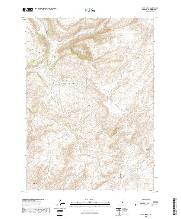
2021 Map of Sheep Creek
USGS Topo · Published 2021About this map
The Old Casper Medicine Bow Hwy winds through this section of Natrona County, tracing a path through the distinctive geological bowl known as Bates Hole. This terrain is defined by a series of drainages that feed the primary waterways, including the meandering course of Bates Creek and Kerfoot Creek. The map documents a landscape where early twentieth-century automotive routes followed the natural contours of the land, providing a critical link between the regional hubs of Casper and Medicine Bow. Water remains the central feature of this high-desert environment, with specific points of interest like Indian Spring and the drainage at Mud Springs Draw marking essential resources in an otherwise arid expanse. The complex network of creeks, such as Chalk Creek and Sheep Creek, illustrates the intricate erosion patterns that have shaped the central Wyoming basin.
Find a feature on this map
16 named features on this map. Tap any name to fly to it.
Don’t see what you’re looking for? This feature index may not catch every label — zoom into the map to look around manually.
Map Details
Editions of this 2021 Sheep Creek Map
This is the sole edition of this map. No revisions or reprints were ever made.
Other maps of this area

1955 · Casper
USGS Topo · 1:250,000

1958 · Casper
USGS Topo · 1:250,000

1959 · Bates Creek Reservoir
USGS Topo · 1:24,000

1960 · Twin Buttes
USGS Topo · 1:24,000

1960 · Crimson Dawn
USGS Topo · 1:24,000

1960 · Horse Peak
USGS Topo · 1:24,000

1960 · Sheep Creek
USGS Topo · 1:24,000

1960 · Mud Springs
USGS Topo · 1:24,000

1960 · Ice Cave Mountain
USGS Topo · 1:24,000
1960 · Freeland
USGS Topo · 1:24,000