
1960 Map of Sheep Creek
USGS Topo · Published 1964About this map
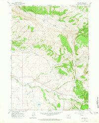
Old Casper Medicine Bow Highway winds through this 1960 landscape in Natrona County, serving as the primary artery for a sparsely settled region defined by wide drainages and isolated ranching outposts. The terrain is dominated by the complex erosion patterns of Bates Hole, where the land drops away into a series of draws including Kerfoot Draw and Chalk Mud Draw. Local history is anchored at the Milne Ranch and Steeple Ranch, which represent the enduring livestock operations of central Wyoming. Water sources, vital for survival in this environment, are clearly marked at Mud Springs and Indian Spring. The map captures the area just before modern highway developments, showing the small settlement of Holin and the winding course of Sheep Creek as they appeared during the mid-twentieth century.
Find a feature on this map
12 named features on this map. Tap any name to fly to it.
Don’t see what you’re looking for? This feature index may not catch every label — zoom into the map to look around manually.
Map Details
Editions of this 1960 Sheep Creek Map
This is the sole edition of this map. No revisions or reprints were ever made.
Other maps of this area

1955 · Casper
USGS Topo · 1:250,000

1958 · Casper
USGS Topo · 1:250,000

1959 · Bates Creek Reservoir
USGS Topo · 1:24,000

1960 · Twin Buttes
USGS Topo · 1:24,000

1960 · Crimson Dawn
USGS Topo · 1:24,000

1960 · Horse Peak
USGS Topo · 1:24,000

1960 · Mud Springs
USGS Topo · 1:24,000

1960 · Ice Cave Mountain
USGS Topo · 1:24,000
1960 · Freeland
USGS Topo · 1:24,000
1960 · Otter Creek
USGS Topo · 1:24,000