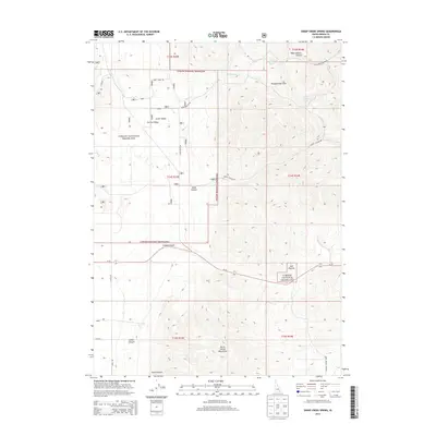
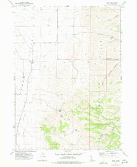
2013 Map of Sheep Creek Spring
USGS Topo · Published 2013About this map
Curlew National Grassland dominates this high-desert landscape in Oneida County, Idaho, where the natural intersection of Arbon Valley and Curlew Valley creates a significant geological and historical corridor. The map reveals a remote ranching and grazing environment defined by isolated water sources such as Sheep Creek Spring and Wood Canyon Spring, which were vital for livestock and settlement in this semi-arid region. To the south, the North Hansel Mountains rise above the drainage systems of Ireland Canyon and Stark Canyon, while the Pleasantview Hills anchor the northern reaches. This 2013 survey details the network of remote mountain roads, including Sheep Creek Rd and Ireland Canyon Rd, that navigate the deep canyons and broad valleys of this intermountain basin.
Find a feature on this map
29 named features on this map. Tap any name to fly to it.
Don’t see what you’re looking for? This feature index may not catch every label — zoom into the map to look around manually.
Map Details
Editions of this 2013 Sheep Creek Spring Map
This is the sole edition of this map. No revisions or reprints were ever made.
Other maps of this area

1954 · Pocatello
USGS Topo · 1:250,000

1958 · Pocatello
USGS Topo · 1:250,000

1963 · Daniels
USGS Topo · 1:24,000

1968 · Ireland Springs
USGS Topo · 1:24,000

1968 · Grover Canyon
USGS Topo · 1:24,000

1968 · Daniels
USGS Topo · 1:24,000
1973 · Stone
USGS Topo · 1:24,000
1973 · Sheep Creek Spring
USGS Topo · 1:24,000
1973 · Holbrook
USGS Topo · 1:24,000
1973 · Buist
USGS Topo · 1:24,000