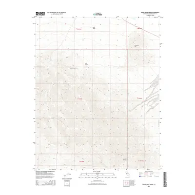
2015 Map of Sheep Creek Spring
USGS Topo · Published 2015About this map
Death Valley and the northern reaches of the Mojave Desert converge in this high-resolution study of San Bernardino County's arid interior. The landscape is defined by its scarce but vital water sources, such as Sheep Creek Spring and the historically significant Old Mormon Spring, which served as critical landmarks for desert travelers. The topography transitions from the dramatic elevations of the Avawatz Mountains in the south to the low-lying Salt Spring Hills and the drainage of Salt Cr in the north. The presence of Anvil Canyon provides a natural corridor through the steep terrain, while State Route 127 cuts across the northeastern corner, marking the modern path through this unforgiving environment. For researchers, the map clarifies the spatial relationship between these named springs and the surrounding mountain ranges before the more extreme desert floor of the basin.
Find a feature on this map
15 named features on this map. Tap any name to fly to it.
Don’t see what you’re looking for? This feature index may not catch every label — zoom into the map to look around manually.
Map Details
Editions of this 2015 Sheep Creek Spring Map
This is the sole edition of this map. No revisions or reprints were ever made.
Other maps of this area

1933 · Avawatz Mountains
USGS Topo · 1:250,000

1947 · Trona
USGS Topo · 1:250,000

1948 · Red Pass Lake
USGS Topo · 1:62,500

1948 · Trona
USGS Topo · 1:250,000

1948 · Avawatz Pass
USGS Topo · 1:62,500

1951 · Avawatz Pass
USGS Topo · 1:62,500

1951 · Red Pass Lake
USGS Topo · 1:62,500

1953 · Trona
USGS Topo · 1:250,000

1956 · Silurian Hills
USGS Topo · 1:62,500

1956 · Baker
USGS Topo · 1:62,500