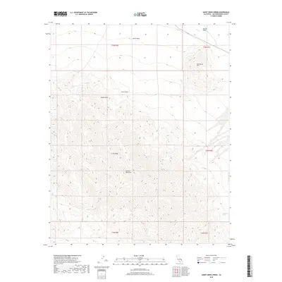
2018 Map of Sheep Creek Spring
USGS Topo · Published 2018About this map
Sheep Creek Spring and Old Mormon Spring serve as vital water markers in this arid stretch of the Mojave Desert. The landscape is dominated by the steep elevation gains of the Avawatz Mountains, which give way to the lower-lying expanse of Death Valley to the north and the Silurian Valley to the northeast. Topographic contours detail the dramatic relief of the Salt Spring Hills and the winding path of Anvil Canyon, illustrating the drainage patterns that feed into ephemeral watercourses like Salt Cr. This survey documents a wilderness area defined by its geological extremes and the scarce water sources that historically dictated travel and survival in the San Bernardino County backcountry.
Find a feature on this map
15 named features on this map. Tap any name to fly to it.
Don’t see what you’re looking for? This feature index may not catch every label — zoom into the map to look around manually.
Map Details
Editions of this 2018 Sheep Creek Spring Map
This is the sole edition of this map. No revisions or reprints were ever made.
Other maps of this area

1933 · Avawatz Mountains
USGS Topo · 1:250,000

1947 · Trona
USGS Topo · 1:250,000

1948 · Red Pass Lake
USGS Topo · 1:62,500

1948 · Trona
USGS Topo · 1:250,000

1948 · Avawatz Pass
USGS Topo · 1:62,500

1951 · Avawatz Pass
USGS Topo · 1:62,500

1951 · Red Pass Lake
USGS Topo · 1:62,500

1953 · Trona
USGS Topo · 1:250,000

1956 · Silurian Hills
USGS Topo · 1:62,500

1956 · Baker
USGS Topo · 1:62,500