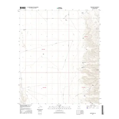
2017 Map of Sheep Draw
USGS Topo · Published 2017About this map
Brokeoff Mountains dominate the eastern landscape of this Otero County region, where the high desert terrain transitions into a complex system of drainage and relief. The area is defined by its dramatic canyons, including North Hammock Canyon, South Hammock Canyon, and Sheep Draw. These features carve through the upland areas, eventually opening into the expansive Crow Flats to the west.
Find a feature on this map
27 named features on this map. Tap any name to fly to it.
Don’t see what you’re looking for? This feature index may not catch every label — zoom into the map to look around manually.
Map Details
Editions of this 2017 Sheep Draw Map
This is the sole edition of this map. No revisions or reprints were ever made.
Other maps of this area

1935 · El Paso Gap
USGS Topo · 1:62,500

1936 · El Paso Gap
USGS Topo · 1:48,000

1940 · El Paso Gap
USGS Topo · 1:62,500

1943 · Texas Hill
USGS Topo · 1:62,500

1945 · Texas Hill
USGS Topo · 1:62,500

1954 · Carlsbad
USGS Topo · 1:250,000

1958 · Carlsbad
USGS Topo · 1:250,000

1963 · Hackberry Hill
USGS Topo · 1:24,000

1963 · Gowdy Ranch
USGS Topo · 1:24,000

1969 · Lewis Canyon
USGS Topo · 1:24,000