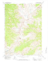
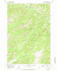
1970 Map of Sheep Mesa
USGS Topo · Published 1973About this map
Sheep Mesa and the surrounding high-altitude terrain of the Shoshone National Forest define this 1970s landscape in Park County. The map details a complex system of drainages, including Blackwater Creek and Fishhawk Creek, which carve through the Washakie Wilderness. Significant landmarks like the Blackwater Natural Bridge and Coxcomb Mountain provide clear orientation points for researchers of Wyoming's wilderness history.
Find a feature on this map
27 named features on this map. Tap any name to fly to it.
Don’t see what you’re looking for? This feature index may not catch every label — zoom into the map to look around manually.
Map Details
Editions of this 1970 Sheep Mesa Map
This is the sole edition of this map. No revisions or reprints were ever made.
Other maps of this area

1893 · Ishawooa
USGS Topo · 1:125,000

1895 · Ishawooa
USGS Topo · 1:125,000

1899 · Ishawooa
USGS Topo · 1:125,000

1955 · Cody
USGS Topo · 1:250,000

1958 · Cody
USGS Topo · 1:250,000

1962 · Cody
USGS Topo · 1:250,000
1970 · Chimney Rock
USGS Topo · 1:24,000
1970 · Clouds Home Peak
USGS Topo · 1:24,000
1970 · Clayton Mountain
USGS Topo · 1:24,000
1970 · Eagle Creek
USGS Topo · 1:24,000