
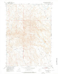
1951 Map of Sheep Mountain
USGS Topo · Published 1953About this map
Sheep Mountain and Tatman Mountain dominate this 1951 survey of the Big Horn Basin, where the high-elevation terrain is carved by a complex network of ephemeral drainage systems. The landscape is defined by the contrast between these prominent uplands and the intricate irrigation efforts found to the north, evidenced by the St Joe Canal. Water management is central to the era's geography, with small-scale improvements like Neres Reservoir and Dobson Pond scattered across the arid slopes. Numerous named drainages, including Dry Creek, Cottonwood Creek, and Rock Waterhole Creek, illustrate the natural erosion patterns of the Wyoming badlands. This mapping, conducted for the Department of the Interior's Missouri River Basin development program, provides a detailed view of the remote ranching and grazing lands between major settlements during the early postwar period.
Find a feature on this map
13 named features on this map. Tap any name to fly to it.
Don’t see what you’re looking for? This feature index may not catch every label — zoom into the map to look around manually.
Map Details
Editions of this 1951 Sheep Mountain Map
2 editions found
Other maps of this area

1951 · Burlington
USGS Topo · 1:24,000

1951 · Sucker Dam
USGS Topo · 1:24,000

1951 · Y U Bench NE
USGS Topo · 1:24,000

1951 · Tatman Mountain
USGS Topo · 1:24,000

1951 · Wardel Reservoir
USGS Topo · 1:24,000

1951 · Otto
USGS Topo · 1:24,000

1951 · Dead Indian Hill
USGS Topo · 1:24,000

1951 · Dutch Nick Flat NW
USGS Topo · 1:24,000

1955 · Cody
USGS Topo · 1:250,000

1958 · Cody
USGS Topo · 1:250,000