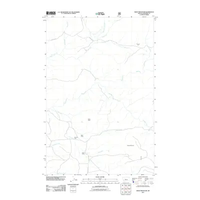
2011 Map of Sheep Mountain
USGS Topo · Published 2011About this map
Sheep Mountain dominates the southeastern quadrant of this Meagher County landscape, providing a high-elevation anchor for a complex network of drainages. The area is characterized by sparse ranching infrastructure, notably the Mc Guire Ranch in the northeast, connected by rudimentary routes like Sheep Creek Rd and Butte Creek Rd. The terrain is defined by significant geographical features including Rocky Ridge and the Elk Horn Pass, which serves as a natural transit point between the various gulches and prairies.
Find a feature on this map
21 named features on this map. Tap any name to fly to it.
Don’t see what you’re looking for? This feature index may not catch every label — zoom into the map to look around manually.
Map Details
Editions of this 2011 Sheep Mountain Map
This is the sole edition of this map. No revisions or reprints were ever made.
Other maps of this area

1886 · Fort Logan
USGS Topo · 1:250,000

1886 · Little Belt Mts.
USGS Topo · 1:250,000

1894 · Little Belt Mts.
USGS Topo · 1:250,000

1897 · Little Belt Mts.
USGS Topo · 1:250,000

1898 · Little Belt Mts.
USGS Topo · 1:250,000

1902 · Little Belt Mts.
USGS Topo · 1:250,000

1948 · White Sulphur Springs
USGS Topo · 1:250,000

1958 · White Sulphur Springs
USGS Topo · 1:250,000

1961 · White Sulphur Springs
USGS Topo · 1:250,000

1965 · White Sulphur Springs
USGS Topo · 1:250,000