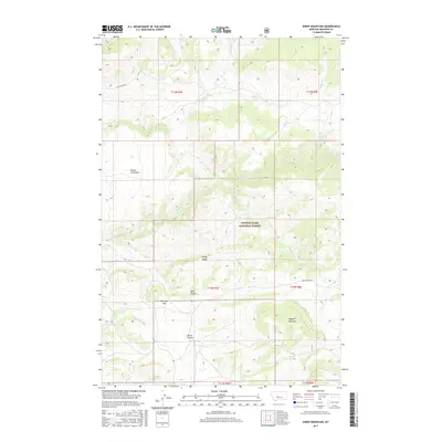
2017 Map of Sheep Mountain
USGS Topo · Published 2017About this map
Lewis & Clark National Forest dominates this section of Meagher County, revealing a high-altitude landscape defined by the drainages of Sheep Creek and the Smith River Rd corridor. The terrain is marked by significant topographical landmarks used for navigation and livestock management, such as Rocky Ridge and the broad Horse Prairie. At Elk Horn Pass, the map illustrates a natural transition point between the drainages of Cottonwood Creek and Bear Gulch. The prominence of Sheep Mountain in the southeast corner anchor the area's geography, while naming conventions like Sheep Creek Bar reflect the local landform use within the forest boundaries. The network of creeks, including Big Butte Creek and Eagle Creek, underscores the complex watershed systems that have shaped this portion of Montana for generations.
Find a feature on this map
26 named features on this map. Tap any name to fly to it.
Don’t see what you’re looking for? This feature index may not catch every label — zoom into the map to look around manually.
Map Details
Editions of this 2017 Sheep Mountain Map
This is the sole edition of this map. No revisions or reprints were ever made.
Other maps of this area

1886 · Fort Logan
USGS Topo · 1:250,000

1886 · Little Belt Mts.
USGS Topo · 1:250,000

1894 · Little Belt Mts.
USGS Topo · 1:250,000

1897 · Little Belt Mts.
USGS Topo · 1:250,000

1898 · Little Belt Mts.
USGS Topo · 1:250,000

1902 · Little Belt Mts.
USGS Topo · 1:250,000

1948 · White Sulphur Springs
USGS Topo · 1:250,000

1958 · White Sulphur Springs
USGS Topo · 1:250,000

1961 · White Sulphur Springs
USGS Topo · 1:250,000

1965 · White Sulphur Springs
USGS Topo · 1:250,000