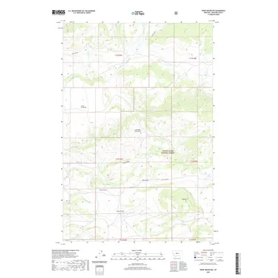
2020 Map of Sheep Mountain
USGS Topo · Published 2020About this map
The Little Belt Mountains dominate this high-country landscape within the Lewis & Clark National Forest. The map detail reveals a complex network of drainage and terrain features that define the Central Montana wilderness, from the heights of Sheep Mtn down to the grassy expanse of Horse Prairie. Travel through this area is traced by early access routes like Smith River Rd and Butte Creek Rd, which navigate the steep gradients between Rocky Ridge and the Bear Gulch drainage. Numerous waterways, including the prominent Sheep Cr and Cottonwood Cr, carve through the geology of the quadrangle. Significant topographical landmarks such as Elk Horn Pass and Sheep Creek Bar suggest the historical transit patterns of hunters and early forest rangers through these high-elevation ranges.
Find a feature on this map
29 named features on this map. Tap any name to fly to it.
Don’t see what you’re looking for? This feature index may not catch every label — zoom into the map to look around manually.
Map Details
Editions of this 2020 Sheep Mountain Map
This is the sole edition of this map. No revisions or reprints were ever made.
Other maps of this area

1886 · Fort Logan
USGS Topo · 1:250,000

1886 · Little Belt Mts.
USGS Topo · 1:250,000

1894 · Little Belt Mts.
USGS Topo · 1:250,000

1897 · Little Belt Mts.
USGS Topo · 1:250,000

1898 · Little Belt Mts.
USGS Topo · 1:250,000

1902 · Little Belt Mts.
USGS Topo · 1:250,000

1948 · White Sulphur Springs
USGS Topo · 1:250,000

1958 · White Sulphur Springs
USGS Topo · 1:250,000

1961 · White Sulphur Springs
USGS Topo · 1:250,000

1965 · White Sulphur Springs
USGS Topo · 1:250,000