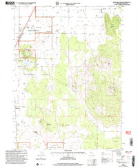
2001 Map of Sheep Mountain
USGS Topo · Published 2004About this map
Butte Valley dominates this High Desert landscape in Northern California, where the flat agricultural basin meets the volcanic uplands of Sheep Mountain. The settlement of Macdoel serves as a primary hub for this arid region, flanked by the Butte Valley National Grassland. The map reveals a land defined by water management and high-altitude features, showing numerous wells scattered across the valley floor and named landmarks like Bramsteads Waterhole.
Find a feature on this map
30 named features on this map. Tap any name to fly to it.
Don’t see what you’re looking for? This feature index may not catch every label — zoom into the map to look around manually.
Map Details
Editions of this 2001 Sheep Mountain Map
This is the sole edition of this map. No revisions or reprints were ever made.
Other maps of this area

1886 · Modoc Lava Bed
USGS Topo · 1:250,000

1886 · Shasta
USGS Topo · 1:250,000

1892 · Modoc Lava-Bed
USGS Topo · 1:250,000

1894 · Shasta
USGS Topo · 1:250,000

1934 · Macdoel
USGS Topo · 1:96,000

1941 · Macdoel
USGS Topo · 1:125,000

1948 · Weed
USGS Topo · 1:250,000

1950 · Weed
USGS Topo · 1:250,000

1950 · Bray
USGS Topo · 1:62,500

1950 · Dorris
USGS Topo · 1:62,500