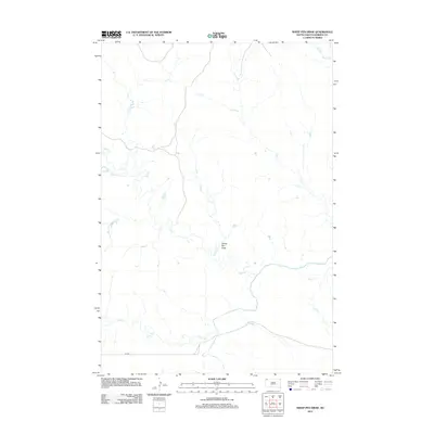
2012 Map of Sheep Pen Draw
USGS Topo · Published 2012About this map
S Fork Grand River meanders across the southeastern portion of this Harding County landscape, marking a primary drainage point for the surrounding plains. The terrain is defined by a dense network of intermittent stream beds and draws, most notably the namesake Sheep Pen Draw which feeds into Bull Cr. These waterways, including Coal Cr and Horse Cr to the north, illustrate the intricate hydrologic patterns characteristic of the high plains, where water movement is seasonal but essential for land use. Human presence is sparse, represented primarily by the linear path of E-6 Rd in the southwest, suggesting a region dedicated to large-scale ranching or grazing where movement is dictated by the natural contours of the various creek systems like Jones Cr and Sand Cr.
Find a feature on this map
9 named features on this map. Tap any name to fly to it.
Don’t see what you’re looking for? This feature index may not catch every label — zoom into the map to look around manually.
Map Details
Editions of this 2012 Sheep Pen Draw Map
This is the sole edition of this map. No revisions or reprints were ever made.
Other maps of this area

1935 · Reva
USGS Topo · 1:125,000

1954 · Lemmon
USGS Topo · 1:250,000

1957 · Lemmon
USGS Topo · 1:250,000

1968 · Ralph SW
USGS Topo · 1:24,000

1968 · Ludlow
USGS Topo · 1:24,000

1968 · Ludlow SE
USGS Topo · 1:24,000

1969 · Battleship Rock
USGS Topo · 1:24,000

1969 · Reva NW
USGS Topo · 1:24,000
1971 · Sheep Pen Draw
USGS Topo · 1:24,000
1971 · Sheep Pen Draw SW
USGS Topo · 1:24,000