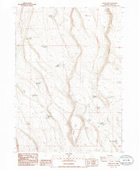
1986 Map of Sheep Rock
USGS Topo · Published 1986About this map
Sheep Rock dominates the rugged high-desert landscape of Lake County, Oregon, as shown in this 1980s topographic survey. The area is characterized by a reliance on widely dispersed water sources, reflected in the numerous named waterholes essential for livestock and wildlife in this arid terrain. Notable examples include the Horse Trap Waterhole, Horsetail Waterhole, and Impossible Waterhole. These features, along with several reservoirs and small lakes like Dead Horse Lake and Walking Plow Lake, indicate the importance of water management in this remote region.
Find a feature on this map
20 named features on this map. Tap any name to fly to it.
Don’t see what you’re looking for? This feature index may not catch every label — zoom into the map to look around manually.
Map Details
Editions of this 1986 Sheep Rock Map
This is the sole edition of this map. No revisions or reprints were ever made.
Other maps of this area

1955 · Crescent
USGS Topo · 1:250,000

1955 · Klamath Falls
USGS Topo · 1:250,000

1957 · Crescent
USGS Topo · 1:250,000

1958 · Crescent
USGS Topo · 1:250,000

1958 · Klamath Falls
USGS Topo · 1:250,000

1970 · Crescent
USGS Topo · 1:250,000

1974 · Lake Abert
USGS Topo · 1:100,000
1985 · Fire Lake
USGS Topo · 1:24,000
1985 · Diatomite Reservoir
USGS Topo · 1:24,000

1986 · St. Patrick Mtn.
USGS Topo · 1:24,000