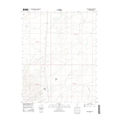
2013 Map of Sheep Springs
USGS Topo · Published 2013About this map
Sheep Springs serves as the primary focal point of this San Juan County landscape, situated where the high desert terrain meets a network of vital transportation corridors. The settlement pattern is defined by its proximity to several drainage systems, most notably Tuntsa Wash and Sheep Springs Wash, which weave through the arid geography. The map reveals a specific infrastructure of Indian Service Route 31 and Indian Service Route 69, alongside secondary routes like Ind Sr 5029. Rising above the local drainage basins, the prominent landform of Grey Mesa stands in the northwest corner, providing a stark topographical contrast to the basin floor. This 2013 survey provides a contemporary look at the small settlement of Black House and the broader grazing and ranching territories of the Shiprock Agency region.
Find a feature on this map
14 named features on this map. Tap any name to fly to it.
Don’t see what you’re looking for? This feature index may not catch every label — zoom into the map to look around manually.
Map Details
Editions of this 2013 Sheep Springs Map
This is the sole edition of this map. No revisions or reprints were ever made.
Other maps of this area

1889 · Chaco
USGS Topo · 1:250,000

1892 · Chaco
USGS Topo · 1:250,000

1927 · Sulphur Spring
USGS Topo · 1:96,000

1928 · Kirtland
USGS Topo · 1:125,000

1932 · Kirtland
USGS Topo · 1:125,000

1953 · Sanostee
USGS Topo · 1:62,500

1954 · Shiprock
USGS Topo · 1:250,000

1958 · Shiprock
USGS Topo · 1:250,000

1959 · Shiprock
USGS Topo · 1:250,000
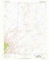
1966 · Sheep Springs
USGS Topo · 1:24,000