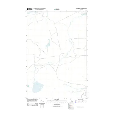
2011 Map of Sheephead Lake
USGS Topo · Published 2011About this map
Shelldrake River winds through this Upper Peninsula landscape, connecting a complex system of waterways and remote access routes in Luce County. The river forms a significant drainage basin, including the South Branch Shelldrake River and a notable broadening known as The Widewaters in the northeast. The southern portion of the area is dominated by Sheephead Lake and the eastern edge of Betsy Lake, highlighting the wetland character of the terrain.
Find a feature on this map
32 named features on this map. Tap any name to fly to it.
Don’t see what you’re looking for? This feature index may not catch every label — zoom into the map to look around manually.
Map Details
Editions of this 2011 Sheephead Lake Map
This is the sole edition of this map. No revisions or reprints were ever made.
Other maps of this area

1951 · Vermilion SE
USGS Topo · 1:24,000

1951 · Shelldrake
USGS Topo · 1:24,000

1951 · Vermilion
USGS Topo · 1:24,000

1951 · Sheephead Lake
USGS Topo · 1:24,000

1951 · Emerson
USGS Topo · 1:24,000

1951 · Timberlost
USGS Topo · 1:24,000

1951 · Shelldrake
USGS Topo · 1:62,500

1954 · Sault Sainte Marie
USGS Topo · 1:250,000

1956 · Sault Sainte Marie
USGS Topo · 1:250,000

1957 · Sault Sainte Marie
USGS Topo · 1:250,000