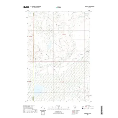
2019 Map of Sheephead Lake
USGS Topo · Published 2019About this map
Shelldrake River winds through the wetlands of McMillan Township, defining the drainage patterns of this sparsely settled corner of the Upper Peninsula. The landscape is dominated by complex water systems, from the expansive Goose Marsh to the broadened channel of The Widewaters. Near the boundary of Luce Co and Chippewa Co, Sheephead Lake sits surrounded by a network of timber and farm trails, reflecting the area's continued reliance on seasonal access and resource management. The intricate topography of the S Br Shelldrake River and Bronson Cr illustrates a terrain largely shaped by glacial deposits, where narrow roads like W Betsy River Rd and N Maple Block Rd provide the only passage through the dense marshes and forests.
Find a feature on this map
34 named features on this map. Tap any name to fly to it.
Don’t see what you’re looking for? This feature index may not catch every label — zoom into the map to look around manually.
Map Details
Editions of this 2019 Sheephead Lake Map
This is the sole edition of this map. No revisions or reprints were ever made.
Other maps of this area

1951 · Vermilion SE
USGS Topo · 1:24,000

1951 · Shelldrake
USGS Topo · 1:24,000

1951 · Vermilion
USGS Topo · 1:24,000

1951 · Sheephead Lake
USGS Topo · 1:24,000

1951 · Emerson
USGS Topo · 1:24,000

1951 · Timberlost
USGS Topo · 1:24,000

1951 · Shelldrake
USGS Topo · 1:62,500

1954 · Sault Sainte Marie
USGS Topo · 1:250,000

1956 · Sault Sainte Marie
USGS Topo · 1:250,000

1957 · Sault Sainte Marie
USGS Topo · 1:250,000