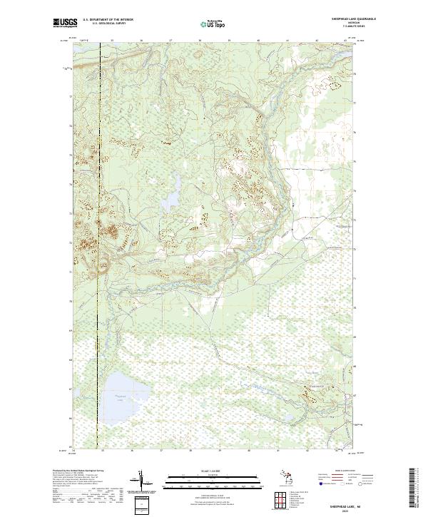
2023 Map of Sheephead Lake
USGS Topo · Published 2023About this map
Shelldrake River winds through this section of the Upper Peninsula, carving a path through the wetlands and forests of Chippewa Co and Luce Co. The landscape is defined by its complex hydrology, featuring the expansive Goose Marsh and the South Branch Shelldrake River to the south. Sheephead Lake serves as a prominent landmark in the southwestern quadrant, surrounded by a network of seasonal trails and forest roads like W Farm Truck Trl and N Sheephead Rd. This modern survey illustrates the enduring wilderness character of the region, where roads such as W Betsy River Rd and W Vermillion Rd provide limited access to the interior. The map records the contemporary boundaries of townships like t50n r7w and t49n r7w, showing how the land remains partitioned by the Public Land Survey System amidst the natural drainages of Browns Creek.
Find a feature on this map
37 named features on this map. Tap any name to fly to it.
Don’t see what you’re looking for? This feature index may not catch every label — zoom into the map to look around manually.
Map Details
Editions of this 2023 Sheephead Lake Map
This is the sole edition of this map. No revisions or reprints were ever made.
Other maps of this area

1951 · Vermilion SE
USGS Topo · 1:24,000

1951 · Shelldrake
USGS Topo · 1:24,000

1951 · Vermilion
USGS Topo · 1:24,000

1951 · Sheephead Lake
USGS Topo · 1:24,000

1951 · Emerson
USGS Topo · 1:24,000

1951 · Timberlost
USGS Topo · 1:24,000

1951 · Shelldrake
USGS Topo · 1:62,500

1954 · Sault Sainte Marie
USGS Topo · 1:250,000

1956 · Sault Sainte Marie
USGS Topo · 1:250,000

1957 · Sault Sainte Marie
USGS Topo · 1:250,000