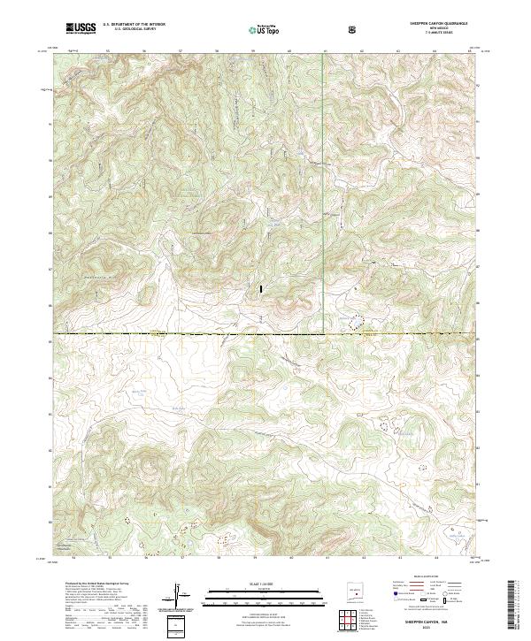
2023 Map of Sheeppen Canyon
USGS Topo · Published 2023About this map
The Sacramento Mountains define the high-elevation landscape of this region within the Lincoln National Forest. The map reveals a complex network of drainages and named canyons, including Sheeppen Canyon, Tunstall Canyon, and Alamo Canyon, which carve through the terrain between the Lincoln and Otero county line. Water resources are primarily captured in a series of tanks and small lakes, such as Prairie Dog Tank, Zamora Lake, and Burro Lake, reflecting the vital importance of water management in this arid montane environment.
Find a feature on this map
32 named features on this map. Tap any name to fly to it.
Don’t see what you’re looking for? This feature index may not catch every label — zoom into the map to look around manually.
Map Details
Editions of this 2023 Sheeppen Canyon Map
This is the sole edition of this map. No revisions or reprints were ever made.
Other maps of this area

1955 · Roswell
USGS Topo · 1:250,000

1958 · Roswell
USGS Topo · 1:250,000

1961 · Lincoln
USGS Topo · 1:62,500

1962 · Roswell
USGS Topo · 1:250,000

1963 · Fort Stanton
USGS Topo · 1:24,000

1963 · Deadman Lake
USGS Topo · 1:24,000

1963 · Ruidoso Downs
USGS Topo · 1:24,000
1963 · Pajarita Mountain
USGS Topo · 1:24,000
1963 · Whitetail
USGS Topo · 1:24,000

1984 · Ruidoso
USGS Topo · 1:100,000