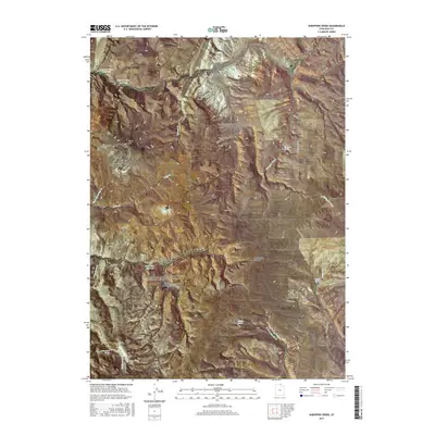
2017 Map of Sheeppen Creek
USGS Topo · Published 2017About this map
Peterson Dry Farms sits on the high eastern plateau of this Rich County landscape, representing the agricultural persistence required in this high-altitude environment. The drainage systems are complex, characterized by the branching forks of South Fork North Eden Canyon and South Eden Canyon, which channel seasonal runoff toward the Bear Lake basin just beyond the western map edge. Water management is central to the area's utility, evidenced by a series of high-country impoundments including Upper N Eden Reservoir, Lower N Eden Reservoir, and South Eden Reservoir. Local springs such as Sheeppen Spring, Rabbit Spring, and Shirley Spring provided critical water sources for livestock and early travelers navigating the high ridges. These features, along with landmarks like Black Mtn, trace a history of ranching and resource management in the Utah backcountry.
Find a feature on this map
31 named features on this map. Tap any name to fly to it.
Don’t see what you’re looking for? This feature index may not catch every label — zoom into the map to look around manually.
Map Details
Editions of this 2017 Sheeppen Creek Map
This is the sole edition of this map. No revisions or reprints were ever made.
Other maps of this area

1909 · Montpelier
USGS Topo · 1:125,000

1911 · Montpelier
USGS Topo · 1:125,000

1912 · Randolph
USGS Topo · 1:125,000

1954 · Ogden
USGS Topo · 1:250,000

1955 · Preston
USGS Topo · 1:250,000

1958 · Ogden
USGS Topo · 1:250,000

1958 · Preston
USGS Topo · 1:250,000

1960 · Ogden
USGS Topo · 1:250,000

1962 · Preston
USGS Topo · 1:250,000

1969 · Sheeppen Creek
USGS Topo · 1:24,000