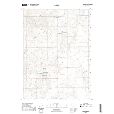
2020 Map of Sheeppen Creek
USGS Topo · Published 2020About this map
Lower North Eden Reservoir and Upper North Eden Reservoir anchor the northwestern portion of this high-elevation terrain in Rich County. The landscape is defined by the complex drainage systems of South Eden Canyon and the multiple forks of North Eden Canyon, reflecting a remote ranching and watershed environment. Evidence of agricultural activity is found at Peterson Dry Farms, while the presence of scattered water sources like Sheeppen Spring, Rabbit Spring, and Shirley Spring indicates the critical importance of reliable water in this arid upland. These springs and the courses of Cottonwood Cr and Sheeppen Cr highlight the natural resource patterns that have sustained local land use. Access through this area is largely limited to unpaved routes such as Rabbit Creek Rd, which winds through the eastern valleys.
Find a feature on this map
25 named features on this map. Tap any name to fly to it.
Don’t see what you’re looking for? This feature index may not catch every label — zoom into the map to look around manually.
Map Details
Editions of this 2020 Sheeppen Creek Map
This is the sole edition of this map. No revisions or reprints were ever made.
Other maps of this area

1909 · Montpelier
USGS Topo · 1:125,000

1911 · Montpelier
USGS Topo · 1:125,000

1912 · Randolph
USGS Topo · 1:125,000

1954 · Ogden
USGS Topo · 1:250,000

1955 · Preston
USGS Topo · 1:250,000

1958 · Ogden
USGS Topo · 1:250,000

1958 · Preston
USGS Topo · 1:250,000

1960 · Ogden
USGS Topo · 1:250,000

1962 · Preston
USGS Topo · 1:250,000

1969 · Sheeppen Creek
USGS Topo · 1:24,000