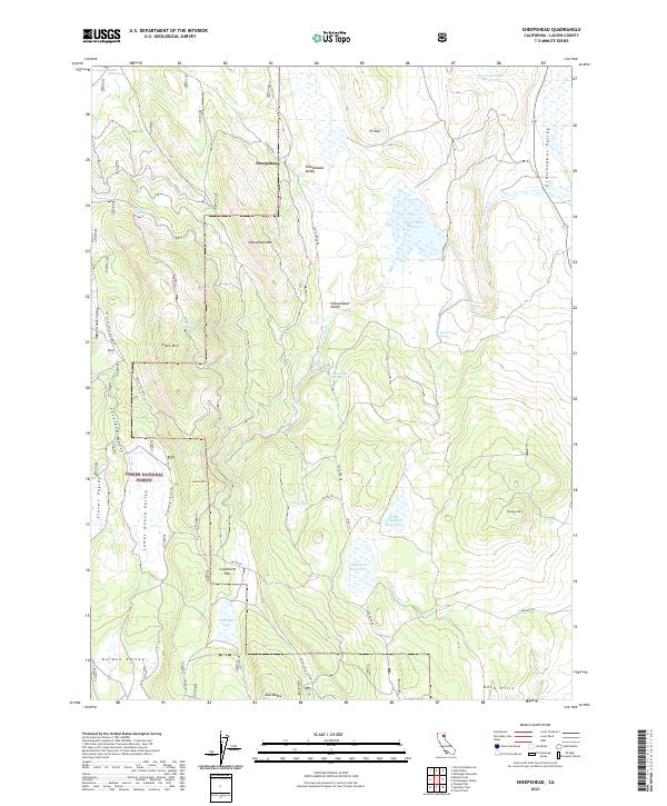
2021 Map of Sheepshead
USGS Topo · Published 2021About this map
Lassen National Forest encompasses the rugged high-country terrain of this quadrangle, characterized by a complex network of volcanic peaks and high-elevation valleys. The settlement of Sheepshead sits at a crossroads in the north-central sector, where Slate Creek Rd meets the drainage of Slate Creek. The landscape is dotted with water management features vital for this arid high-elevation environment, including Cleghorn Reservoir, Heath Dam Reservoir, and Horse Meadow Reservoir.
Find a feature on this map
44 named features on this map. Tap any name to fly to it.
Don’t see what you’re looking for? This feature index may not catch every label — zoom into the map to look around manually.
Map Details
Editions of this 2021 Sheepshead Map
This is the sole edition of this map. No revisions or reprints were ever made.
Other maps of this area

1886 · Honey Lake
USGS Topo · 1:250,000

1891 · Honey Lake
USGS Topo · 1:250,000

1893 · Honey Lake
USGS Topo · 1:250,000

1954 · Grasshopper Valley
USGS Topo · 1:62,500

1954 · Fredonyer Peak
USGS Topo · 1:62,500

1955 · Westwood
USGS Topo · 1:250,000

1956 · Hayden Hill
USGS Topo · 1:62,500

1956 · Antelope Mtn
USGS Topo · 1:62,500

1958 · Westwood
USGS Topo · 1:250,000

1959 · Westwood
USGS Topo · 1:250,000