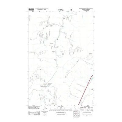
2011 Map of Sheepshead Mountain
USGS Topo · Published 2011About this map
Sheepshead Mountain dominates the center of this Jefferson County landscape, a terrain defined by the complex drainage systems of the Boulder River and Lowland Creek. The map reflects a legacy of extraction, marking specific claims such as the Ruby Mine and several section-indexed operations like the NW NW Section 13 Mine. Along the lower reaches of Lowland Creek, the Lowland Creek Dam and Maney Lake suggest a managed water system that supports both the local ecology and recreational interests at the Sheepshead Recreation Area and Freedom Point Campground. Further east, the alignment of West Elk Park Rd follows the valley of Bison Creek, passing the Ice Pond. This 2011 survey captures the coexistence of working ranch lands like the Irvine Ranch with modern forest management and recreation in the Montana high country.
Find a feature on this map
41 named features on this map. Tap any name to fly to it.
Don’t see what you’re looking for? This feature index may not catch every label — zoom into the map to look around manually.
Map Details
Editions of this 2011 Sheepshead Mountain Map
This is the sole edition of this map. No revisions or reprints were ever made.
Other maps of this area

1889 · Helena
USGS Topo · 1:250,000

1893 · Helena
USGS Topo · 1:250,000

1899 · Boulder
USGS Topo · 1:125,000

1899 · Helena
USGS Topo · 1:250,000

1903 · Helena
USGS Topo · 1:250,000

1947 · Butte
USGS Topo · 1:250,000

1954 · Elk Park
USGS Topo · 1:62,500

1954 · Basin
USGS Topo · 1:62,500

1958 · Butte
USGS Topo · 1:250,000

1959 · Butte North
USGS Topo · 1:62,500