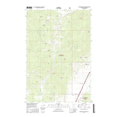
2017 Map of Sheepshead Mountain
USGS Topo · Published 2017About this map
Sheepshead Mtn stands as a prominent landmark within the Deerlodge National Forest, presiding over a landscape defined by an intricate network of drainages and historical mining paths. The topography is deeply incised by numerous gulches, including Placer Gulch, Buffalo Gulch, and Kit Carson Gulch, names that suggest the area's prospecting heritage. Water from these heights feeds into Lowland Cr and Bison Cr, while smaller features like Maney Lake and the Ice Pond provide specific points of interest for local geography.
Find a feature on this map
41 named features on this map. Tap any name to fly to it.
Don’t see what you’re looking for? This feature index may not catch every label — zoom into the map to look around manually.
Map Details
Editions of this 2017 Sheepshead Mountain Map
This is the sole edition of this map. No revisions or reprints were ever made.
Other maps of this area

1889 · Helena
USGS Topo · 1:250,000

1893 · Helena
USGS Topo · 1:250,000

1899 · Boulder
USGS Topo · 1:125,000

1899 · Helena
USGS Topo · 1:250,000

1903 · Helena
USGS Topo · 1:250,000

1947 · Butte
USGS Topo · 1:250,000

1954 · Elk Park
USGS Topo · 1:62,500

1954 · Basin
USGS Topo · 1:62,500

1958 · Butte
USGS Topo · 1:250,000

1959 · Butte North
USGS Topo · 1:62,500