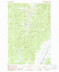
1985 Map of Sheepshead Mountain
USGS Topo · Published 1986About this map
Deerlodge National Forest dominates this mid-1980s mountain terrain, where extractive industry and wilderness management define the landscape. The map reveals a legacy of mining activity through numerous Prospect and Prospects labels scattered across the slopes, particularly near Ramsey Gulch and Ruby Creek. Evidence of historical infrastructure appears along the eastern edge, where the Old Railroad Grade follows the valley floor near Bison Creek, a common sight in Montana's mineral-rich districts where rail lines once serviced remote camps.
Find a feature on this map
39 named features on this map. Tap any name to fly to it.
Don’t see what you’re looking for? This feature index may not catch every label — zoom into the map to look around manually.
Map Details
Editions of this 1985 Sheepshead Mountain Map
This is the sole edition of this map. No revisions or reprints were ever made.
Other maps of this area

1889 · Helena
USGS Topo · 1:250,000

1893 · Helena
USGS Topo · 1:250,000

1899 · Boulder
USGS Topo · 1:125,000

1899 · Helena
USGS Topo · 1:250,000

1903 · Helena
USGS Topo · 1:250,000

1947 · Butte
USGS Topo · 1:250,000

1954 · Elk Park
USGS Topo · 1:62,500

1954 · Basin
USGS Topo · 1:62,500

1958 · Butte
USGS Topo · 1:250,000

1959 · Butte North
USGS Topo · 1:62,500