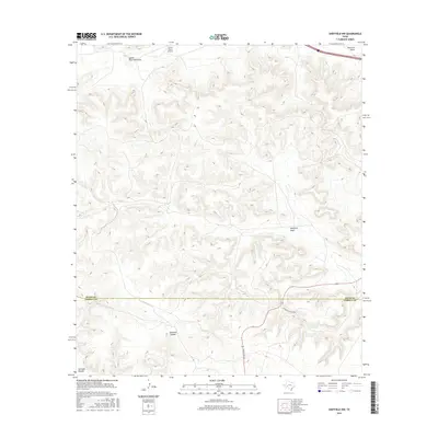
2016 Map of Sheffield NW
USGS Topo · Published 2016About this map
Canon Ranch Airport sits at the northern edge of this high-plateau landscape, where the Pecos and Terrell county line divides the limestone breaks of West Texas. The terrain is defined by a series of significant drainage systems, including Lower Fourmile Draw and Sheffield Draw, which carve deep paths through the upland. This 2016 survey illustrates the intersection of modern infrastructure and a land primarily used for large-scale ranching, as evidenced by Seventeen Ranch Rd and Ranch Rd 1217. Named topographic features such as Bearfoot Canyon and Surveyor Canyon indicate the deeply eroded nature of the local geography. While I-10 crosses the northern corner, the majority of the area remains dominated by cattle country and the winding draws that guide seasonal water flow toward the Pecos River valley.
Find a feature on this map
11 named features on this map. Tap any name to fly to it.
Don’t see what you’re looking for? This feature index may not catch every label — zoom into the map to look around manually.
Map Details
Editions of this 2016 Sheffield NW Map
This is the sole edition of this map. No revisions or reprints were ever made.
Other maps of this area

1929 · Sheffield
USGS Topo · 1:125,000

1929 · Independence Draw Quadrangle
USGS Topo · 1:125,000

1954 · Fort Stockton
USGS Topo · 1:250,000

1954 · Sonora
USGS Topo · 1:250,000

1958 · Sonora
USGS Topo · 1:250,000

1958 · Fort Stockton
USGS Topo · 1:250,000

1967 · Divide Country
USGS Topo · 1:24,000

1967 · Sheffield NW
USGS Topo · 1:24,000

1967 · Horsehead Canyon
USGS Topo · 1:24,000

1967 · Deer Canyon
USGS Topo · 1:24,000