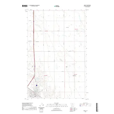
2020 Map of Shelby
USGS Topo · Published 2020About this map
Shelby serves as the focal point of this Northern Montana landscape, concentrated around its grid of streets such as Main St and Sheridan Ave. The town is anchored by the Toole County Courthouse and its historical rail connection, marked by the Great Northern Railway-Overpass. The surrounding prairie is defined by a system of intermittent drainage channels including Mead Coulee, Hall Coulee, and the North Fork Dunkirk Coulee, which shape the agricultural and transit corridors of the region.
Find a feature on this map
51 named features on this map. Tap any name to fly to it.
Don’t see what you’re looking for? This feature index may not catch every label — zoom into the map to look around manually.
Map Details
Editions of this 2020 Shelby Map
This is the sole edition of this map. No revisions or reprints were ever made.
Other maps of this area

1920 · Conrad
USGS Topo · 1:125,000

1943 · Antelope Coulee
USGS Topo · 1:62,500

1943 · Shelby
USGS Topo · 1:62,500

1954 · Shelby
USGS Topo · 1:250,000

1958 · Shelby
USGS Topo · 1:250,000

1967 · Naismith
USGS Topo · 1:24,000

1967 · Dunkirk
USGS Topo · 1:24,000
1967 · Ledger NW
USGS Topo · 1:24,000
1984 · Conrad
USGS Topo · 1:100,000

1984 · Sweet Grass Hills
USGS Topo · 1:100,000