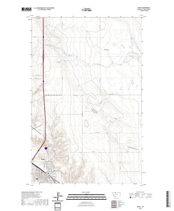
2024 Map of Shelby
USGS Topo · Published 2024About this map
Shelby serves as the focal point of this northern Montana landscape, situated at a junction of regional transport and governance. The town layout is defined by a dense grid of streets including Main St and Front St, while the Toole County Courthouse and Mountain View Cem anchor the community's civic and local history. To the north, the terrain is shaped by a series of drainage features like Mead Coulee and Hall Coulee, which cut through the high plains toward the West Fork Willow Creek. Rural access is maintained through an extensive network of namesake roads such as Kelleher Rd and Jap Evans Rd. The northern outskirts are marked by the Shelby Airport and the recreational waters of Lake Shel-oole, illustrating the shift from the concentrated town center to the expansive agricultural and ranching sections characterized by W Gumbo Joe road.
Find a feature on this map
46 named features on this map. Tap any name to fly to it.
Don’t see what you’re looking for? This feature index may not catch every label — zoom into the map to look around manually.
Map Details
Editions of this 2024 Shelby Map
This is the sole edition of this map. No revisions or reprints were ever made.
Other maps of this area

1920 · Conrad
USGS Topo · 1:125,000

1943 · Antelope Coulee
USGS Topo · 1:62,500

1943 · Shelby
USGS Topo · 1:62,500

1954 · Shelby
USGS Topo · 1:250,000

1958 · Shelby
USGS Topo · 1:250,000

1967 · Naismith
USGS Topo · 1:24,000

1967 · Dunkirk
USGS Topo · 1:24,000
1967 · Ledger NW
USGS Topo · 1:24,000
1984 · Conrad
USGS Topo · 1:100,000

1984 · Sweet Grass Hills
USGS Topo · 1:100,000