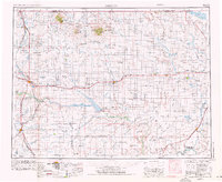
1954 Map of Shelby
USGS Topo · Published 1976About this map
Sweet Grass Hills rise sharply above the high plains of Northern Montana in this mid-century survey, anchoring a landscape defined by the intersection of ranching and the energy industry. The northern border with Canada is punctuated by ports of entry, while the vast southern reaches are shaped by the Marias River and the massive Tiber Reservoir, held by the Tiber Dam. The region's economy is etched into the terrain through extensive oil and gas wells and gas and oil fields that sprawl near Kevin and Sunburst.
Find a feature on this map
87 named features on this map. Tap any name to fly to it.
Don’t see what you’re looking for? This feature index may not catch every label — zoom into the map to look around manually.
Map Details
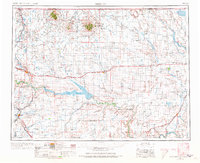
Editions of this 1954 Shelby Map
3 editions found

Other maps of this area

1886 · Great Falls
USGS Topo · 1:250,000

1890 · Fort Benton
USGS Topo · 1:250,000

1892 · Fort Benton
USGS Topo · 1:250,000

1897 · Fort Benton
USGS Topo · 1:250,000

1904 · Assinniboine
USGS Topo · 1:62,500

1904 · Boxelder
USGS Topo · 1:62,500

1906 · Kremlin
USGS Topo · 1:62,500

1906 · Lonesome
USGS Topo · 1:62,500

1906 · Boxelder
USGS Topo · 1:62,500

1909 · Cut Bank
USGS Topo · 1:125,000