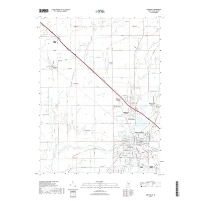
2019 Map of Shelbyville
USGS Topo · Published 2019About this map
Shelbyville sits at the confluence of the Big Blue River and Little Blue River, serving as a central hub for the surrounding agricultural landscape of Shelby County. The town is flanked by numerous residential pockets such as Walkerville, Wellington Heights, and Crestmoor, reflecting its gradual suburban expansion. To the northwest, the settlement of Fairland remains distinct, supported by its own local geography near Brandywine Creek.
Find a feature on this map
131 named features on this map. Tap any name to fly to it.
Don’t see what you’re looking for? This feature index may not catch every label — zoom into the map to look around manually.
Map Details
Editions of this 2019 Shelbyville Map
This is the sole edition of this map. No revisions or reprints were ever made.
Other maps of this area

1942 · Columbus
USGS Topo · 1:125,000

1948 · Lewis Creek
USGS Topo · 1:24,000

1948 · Marietta
USGS Topo · 1:24,000

1950 · Edinburg
USGS Topo · 1:62,500

1952 · Fountaintown
USGS Topo · 1:24,000

1953 · Shelbyville
USGS Topo · 1:24,000

1953 · Acton
USGS Topo · 1:24,000

1953 · Boggstown
USGS Topo · 1:24,000

1953 · Cincinnati
USGS Topo · 1:250,000

1956 · Morristown
USGS Topo · 1:24,000