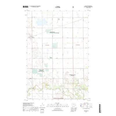
2017 Map of Sheldon
USGS Topo · Published 2017About this map
The Sheyenne River winds through the southern reaches of this landscape, carving a wooded valley that contrasts with the surrounding agricultural prairie. Near the village of Sheldon, the grid of section roads like 57th St SE and 140th Ave SE defines the rural character of Ransom County. The map documents the protected lands of the Sheyenne National Grassland and the Ransom County Waterfowl Production Area, reflecting a region managed for both conservation and public land use. Notable river crossings including McCusker Bridge, Legg Bridge, and Larson Bridge provide critical infrastructure for the small community of Anselm and nearby rural residents. Local aviation is represented by the Kraig Farms Airport, highlighting the integration of farm operations and transportation in this part of North Dakota.
Find a feature on this map
31 named features on this map. Tap any name to fly to it.
Don’t see what you’re looking for? This feature index may not catch every label — zoom into the map to look around manually.
Map Details
Editions of this 2017 Sheldon Map
This is the sole edition of this map. No revisions or reprints were ever made.
Other maps of this area

1895 · Casselton
USGS Topo · 1:125,000

1897 · Tower
USGS Topo · 1:125,000

1897 · Casselton
USGS Topo · 1:125,000

1907 · Wyndmere
USGS Topo · 1:125,000

1953 · Fargo
USGS Topo · 1:250,000

1956 · Fargo
USGS Topo · 1:250,000

1960 · Coburn
USGS Topo · 1:24,000

1960 · Lisbon NE
USGS Topo · 1:24,000

1960 · Enderlin South
USGS Topo · 1:24,000

1960 · Venlo
USGS Topo · 1:24,000