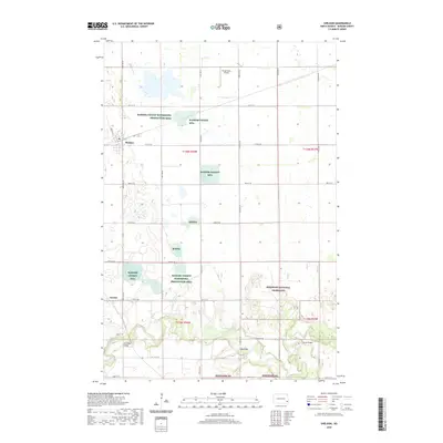
2020 Map of Sheldon
USGS Topo · Published 2020About this map
The agricultural plains of Ransom County define this landscape, where the small community of Sheldon serves as a local hub. The southern portion of the quadrangle shifts toward a more complex riverine environment as the Sheyenne River meanders through the sandy soils and oak savannah of the Sheyenne National Grassland. This area is characterized by a significant conservation footprint, including the Ransom County Waterfowl Production Area and several scattered Rcwp parcels, which protect vital wetland habitats across the prairie. Evidence of local aviation is seen at Kraig Farms Airport, while the settlement of Anselm anchors the southwestern reaches near the river. The map illustrates a strictly rectilinear section-line road network typical of the Red River Valley region, interrupted only by the natural contours of the river valley and the numerous small prairie potholes that dot the township lines.
Find a feature on this map
13 named features on this map. Tap any name to fly to it.
Don’t see what you’re looking for? This feature index may not catch every label — zoom into the map to look around manually.
Map Details
Editions of this 2020 Sheldon Map
This is the sole edition of this map. No revisions or reprints were ever made.
Other maps of this area

1895 · Casselton
USGS Topo · 1:125,000

1897 · Tower
USGS Topo · 1:125,000

1897 · Casselton
USGS Topo · 1:125,000

1907 · Wyndmere
USGS Topo · 1:125,000

1953 · Fargo
USGS Topo · 1:250,000

1956 · Fargo
USGS Topo · 1:250,000

1960 · Coburn
USGS Topo · 1:24,000

1960 · Lisbon NE
USGS Topo · 1:24,000

1960 · Enderlin South
USGS Topo · 1:24,000

1960 · Venlo
USGS Topo · 1:24,000