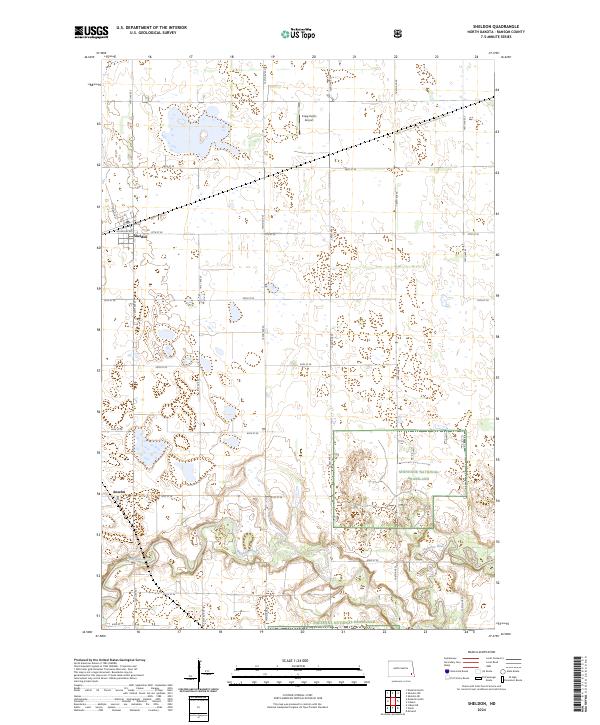
2024 Map of Sheldon
USGS Topo · Published 2024About this map
Sheldon and the nearby settlement of Anselm anchor this portrait of the North Dakota prairie, where a grid of rural section lines meets the natural curves of the Sheyenne River. The southern portion of the landscape is defined by the protected expanse of the Sheyenne National Grassland, while the central and northern reaches are dotted with numerous waterfowl habitats, including the Ransom County Waterfowl Production Area and the Ransom County WPA. Local infrastructure is represented by the Kraig Farms Airport and the distinct residential blocks of Sheldon, where Dakota St and Mountain Ave form the town's core. The map captures a region deeply committed to conservation and agriculture, as evidenced by the widespread Rcwpa designations and the network of well-maintained gravel and local roads like 140th Ave SE and 60th St SE.
Find a feature on this map
29 named features on this map. Tap any name to fly to it.
Don’t see what you’re looking for? This feature index may not catch every label — zoom into the map to look around manually.
Map Details
Editions of this 2024 Sheldon Map
This is the sole edition of this map. No revisions or reprints were ever made.
Other maps of this area

1895 · Casselton
USGS Topo · 1:125,000

1897 · Tower
USGS Topo · 1:125,000

1897 · Casselton
USGS Topo · 1:125,000

1907 · Wyndmere
USGS Topo · 1:125,000

1953 · Fargo
USGS Topo · 1:250,000

1956 · Fargo
USGS Topo · 1:250,000

1960 · Coburn
USGS Topo · 1:24,000

1960 · Lisbon NE
USGS Topo · 1:24,000

1960 · Enderlin South
USGS Topo · 1:24,000

1960 · Venlo
USGS Topo · 1:24,000