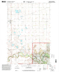
1998 Map of Sheldon
USGS Topo · Published 2000About this map
Sheldon serves as the primary rail-side hub in this late-twentieth-century landscape, situated where the grid of Greene township meets the open prairie. To the south, the terrain transforms as it approaches the Sheyenne River, which carves a deep, winding valley through the plains. This river corridor is home to the Sheyenne National Grassland, a preserved stretch of native ecosystem that stands in contrast to the surrounding agricultural sections. The map records several vital river crossings essential for local transit, including Mcluskey Bridge and Legg Bridge. Near the river valley, the small settlement of Anselm marks another point of human geography within the Owego township area. The transition from the flat, cultivated uplands of Coburn to the complex riparian environment of the river valley highlights the region's reliance on specific topographic corridors for both travel and conservation.
Find a feature on this map
10 named features on this map. Tap any name to fly to it.
Don’t see what you’re looking for? This feature index may not catch every label — zoom into the map to look around manually.
Map Details
Editions of this 1998 Sheldon Map
This is the sole edition of this map. No revisions or reprints were ever made.
Other maps of this area

1895 · Casselton
USGS Topo · 1:125,000

1897 · Tower
USGS Topo · 1:125,000

1897 · Casselton
USGS Topo · 1:125,000

1907 · Wyndmere
USGS Topo · 1:125,000

1953 · Fargo
USGS Topo · 1:250,000

1956 · Fargo
USGS Topo · 1:250,000

1960 · Coburn
USGS Topo · 1:24,000

1960 · Lisbon NE
USGS Topo · 1:24,000

1960 · Enderlin South
USGS Topo · 1:24,000

1960 · Venlo
USGS Topo · 1:24,000