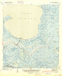
1941 Map of Shell Beach
USGS Topo · Published 1941About this map
Lake Borgne dominates the northern reaches of this coastal landscape, where the marshy wetlands of St. Bernard Parish meet the Gulf. The settlement of Shell Beach sits at a critical junction near the historic site of Old Ft Beauregard, marking a point of historical defense and commerce along the shoreline. Further inland, the map shows the transition from railroad-supported infrastructure to water-based transit, particularly evident where the Old Bayou Railroad Grade terminates near Alluvial City and Yscloskey.
Find a feature on this map
55 named features on this map. Tap any name to fly to it.
Don’t see what you’re looking for? This feature index may not catch every label — zoom into the map to look around manually.
Map Details
Editions of this 1941 Shell Beach Map
2 editions found

Other maps of this area

1891 · Pointe a La Hache
USGS Topo · 1:62,500

1892 · Chef Menteur
USGS Topo · 1:62,500

1892 · St. Bernard
USGS Topo · 1:62,500

1892 · Pointe a La Hache
USGS Topo · 1:62,500

1893 · Rigolets
USGS Topo · 1:62,500

1893 · La Fortuna
USGS Topo · 1:62,500

1893 · Shell Beach
USGS Topo · 1:62,500

1893 · Toulme
USGS Topo · 1:62,500

1893 · Dime
USGS Topo · 1:62,500

1895 · Bodreau
USGS Topo · 1:62,500