
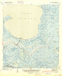
1941 Map of Shell Beach
USGS Topo · Published 1941About this map
Shell Beach sits at the terminus of the Old Bayou Railroad Grade, marking a key point where the land meets the expansive Lake Borgne. This 1939 survey of St. Bernard Parish captures a coastal landscape defined by a complex network of wetlands and tidal channels, including the winding course of La Loutre Bayou. The map documents the presence of Old Ft Beauregard and Camp Hygeia, offering a look at the military and social footprint on this fragile shore before mid-century changes.
Find a feature on this map
63 named features on this map. Tap any name to fly to it.
Don’t see what you’re looking for? This feature index may not catch every label — zoom into the map to look around manually.
Map Details
Editions of this 1941 Shell Beach Map
2 editions found
Other maps of this area

1891 · Pointe a La Hache
USGS Topo · 1:62,500

1892 · Chef Menteur
USGS Topo · 1:62,500

1892 · St. Bernard
USGS Topo · 1:62,500

1892 · Pointe a La Hache
USGS Topo · 1:62,500

1893 · Rigolets
USGS Topo · 1:62,500

1893 · La Fortuna
USGS Topo · 1:62,500

1893 · Shell Beach
USGS Topo · 1:62,500

1893 · Toulme
USGS Topo · 1:62,500

1893 · Dime
USGS Topo · 1:62,500

1895 · Bodreau
USGS Topo · 1:62,500