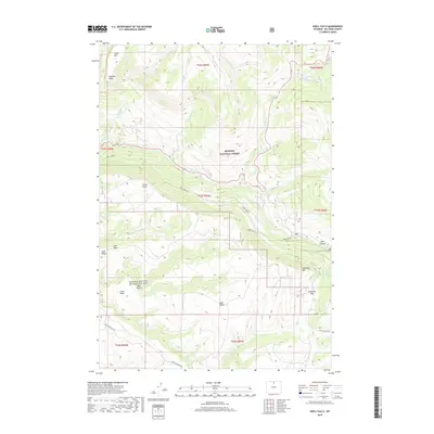
2018 Map of Shell Falls
USGS Topo · Published 2018About this map
Shell Falls stands as the central landmark of this montane landscape within the Bighorn National Forest. The terrain is defined by dramatic elevation changes, notably across the broad plateau of Shell Bench and the deep incision of Shell Canyon. The hydrology of the area is complex, with Shell Creek joined by numerous tributaries including Dry Fork Granite Creek and Brindle Creek. To the north and south, prominent landmarks such as Copmans Tomb, Cedar Mountain, and Snowshoe Mountain anchor the topography. Remote access is marked by the winding path of Black Mountain Road and Battle Creek Road, reflecting the high-altitude transit patterns required to navigate between Snowshoe Pass and the lower drainage basins. This geography illustrates the classic Western transition from high alpine summits to the sharp vertical relief of Wyoming's canyon country.
Find a feature on this map
41 named features on this map. Tap any name to fly to it.
Don’t see what you’re looking for? This feature index may not catch every label — zoom into the map to look around manually.
Map Details
Editions of this 2018 Shell Falls Map
This is the sole edition of this map. No revisions or reprints were ever made.
Other maps of this area

1895 · Dayton
USGS Topo · 1:125,000

1898 · Bald Mountain
USGS Topo · 1:125,000

1899 · Cloud peak
USGS Topo · 1:125,000

1901 · Cloud Peak
USGS Topo · 1:125,000

1901 · Dayton
USGS Topo · 1:125,000

1901 · Bald Mountain
USGS Topo · 1:125,000

1955 · Sheridan
USGS Topo · 1:250,000

1958 · Sheridan
USGS Topo · 1:250,000

1960 · Shell Falls
USGS Topo · 1:24,000

1960 · White Sulphur Spring
USGS Topo · 1:24,000