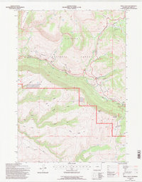
1993 Map of Shell Falls
USGS Topo · Published 1997About this map
Shell Creek carves a dramatic path through this high-elevation section of the Bighorn National Forest, where the landscape is defined by the steep relief of Shell Canyon and the massive limestone formation of Copmans Tomb. This 1993 revision, based on surveys from the 1950s and 1980s, documents the infrastructure of the Bighorn National Forest at the close of the twentieth century. The map highlights key recreational and administrative points, including the Shell Falls Interpretive Site near Shell Falls and the Shell Ranger Station to the east. Higher elevations are marked by the Antelope Butte Ski Area and peaks like Snowshoe Mountain. Tracing the Scenic Byway through the canyon reveals the intricate geography of the Bench and the North Fork and South Fork drainage systems that feed into the main canyon.
Find a feature on this map
48 named features on this map. Tap any name to fly to it.
Don’t see what you’re looking for? This feature index may not catch every label — zoom into the map to look around manually.
Map Details
Editions of this 1993 Shell Falls Map
This is the sole edition of this map. No revisions or reprints were ever made.
Other maps of this area

1895 · Dayton
USGS Topo · 1:125,000

1898 · Bald Mountain
USGS Topo · 1:125,000

1899 · Cloud peak
USGS Topo · 1:125,000

1901 · Cloud Peak
USGS Topo · 1:125,000

1901 · Dayton
USGS Topo · 1:125,000

1901 · Bald Mountain
USGS Topo · 1:125,000

1955 · Sheridan
USGS Topo · 1:250,000

1958 · Sheridan
USGS Topo · 1:250,000

1960 · Shell Falls
USGS Topo · 1:24,000

1960 · White Sulphur Spring
USGS Topo · 1:24,000