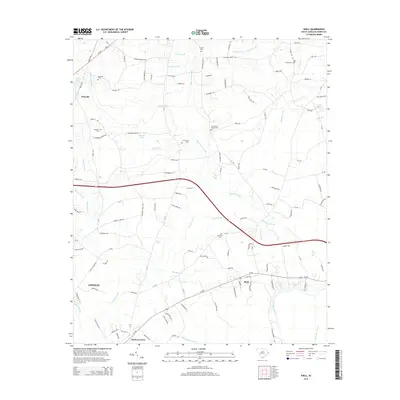
2014 Map of Shell
USGS Topo · Published 2014About this map
Kingston Lake and the Waccamaw River dominate this coastal plain landscape north of Conway, where a network of blackwater swamps and creeks defines the local geography. The map reveals the intricate water systems of Hellhole Swamp, White Oak Swamp, and Alligator Swamp, which have historically shaped development and land use in this part of Horry County. Genealogists will find several notable family and community burial sites, including Anderson Cem, Cherry Hill Cem, and the New Home Church Cem. Small settlements like Howells, Shell, and Hickory Grove are connected by a web of rural routes and shortcuts, reflecting the long-standing agricultural and timber-based economy of the South Carolina Lowcountry. Notable water features such as Opening Pond and Rice Patch Bay further illustrate the unique hydrologic character of the region.
Find a feature on this map
124 named features on this map. Tap any name to fly to it.
Don’t see what you’re looking for? This feature index may not catch every label — zoom into the map to look around manually.
Map Details
Editions of this 2014 Shell Map
This is the sole edition of this map. No revisions or reprints were ever made.
Other maps of this area

1937 · Nixonville
USGS Topo · 1:48,000

1942 · Nixonville
USGS Topo · 1:62,500

1943 · Adrian
USGS Topo · 1:24,000

1943 · Conway
USGS Topo · 1:24,000

1944 · Adrian
USGS Topo · 1:31,680

1948 · Bayboro
USGS Topo · 1:24,000

1949 · Bayboro
USGS Topo · 1:24,000

1949 · Georgetown
USGS Topo · 1:250,000

1953 · Florence
USGS Topo · 1:250,000

1954 · Florence
USGS Topo · 1:250,000