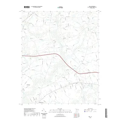
2020 Map of Shell
USGS Topo · Published 2020About this map
Waccamaw River drainage and the extensive wetlands of Horry County define the landscape near the northern reaches of Conway. This 2020 survey documents a complex network of swamplands and bays, including the large Hellhole Swamp in the northwest and White Oak Swamp near the center of the sheet. Small agricultural and residential clusters are scattered throughout, anchored by family cemeteries such as Anderson Cem and Hamilton Cem. The settlement of Shell sits near the confluence of Kingston Lake and localized tributaries, illustrating the long-standing reliance on elevated ground amidst the coastal plains. Features like Rice Patch Bay and Jacks Bay reflect the unique geological depressions common to this region, while the presence of New Home Church Cem and Cherry Hill Cem provide essential anchor points for genealogical research in this rural South Carolina corridor.
Find a feature on this map
134 named features on this map. Tap any name to fly to it.
Don’t see what you’re looking for? This feature index may not catch every label — zoom into the map to look around manually.
Map Details
Editions of this 2020 Shell Map
This is the sole edition of this map. No revisions or reprints were ever made.
Other maps of this area

1937 · Nixonville
USGS Topo · 1:48,000

1942 · Nixonville
USGS Topo · 1:62,500

1943 · Adrian
USGS Topo · 1:24,000

1943 · Conway
USGS Topo · 1:24,000

1944 · Adrian
USGS Topo · 1:31,680

1948 · Bayboro
USGS Topo · 1:24,000

1949 · Bayboro
USGS Topo · 1:24,000

1949 · Georgetown
USGS Topo · 1:250,000

1953 · Florence
USGS Topo · 1:250,000

1954 · Florence
USGS Topo · 1:250,000