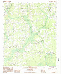
1984 Map of Shell
USGS Topo · Published 1984About this map
Waccamaw River and Kingston Lake define the hydrology of this South Carolina landscape, where expansive wetlands and darkwater swamps dominate the terrain. The community of Shell sits near the riverbanks, serving as a focal point in a region characterized by the intricate drainage systems of Bug Swamp, White Oak Swamp, and Alligator Swamp. The map reveals a deeply rooted rural society, evidenced by numerous family and community cemeteries such as Stevens Cem and Hamilton Cem, alongside local congregations at Bethlehem Ch and Good Hope Ch.
Find a feature on this map
34 named features on this map. Tap any name to fly to it.
Don’t see what you’re looking for? This feature index may not catch every label — zoom into the map to look around manually.
Map Details
Editions of this 1984 Shell Map
This is the sole edition of this map. No revisions or reprints were ever made.
Other maps of this area

1937 · Nixonville
USGS Topo · 1:48,000

1942 · Nixonville
USGS Topo · 1:62,500

1943 · Adrian
USGS Topo · 1:24,000

1943 · Conway
USGS Topo · 1:24,000

1944 · Adrian
USGS Topo · 1:31,680

1948 · Bayboro
USGS Topo · 1:24,000

1949 · Bayboro
USGS Topo · 1:24,000

1949 · Georgetown
USGS Topo · 1:250,000

1953 · Florence
USGS Topo · 1:250,000

1954 · Florence
USGS Topo · 1:250,000