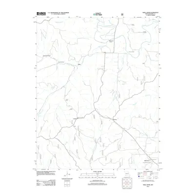
2012 Map of Shell Knob
USGS Topo · Published 2012About this map
The Shell Knob region of Barry County is defined by a landscape carved by the waters of Flat Creek and Rockhouse Creek. During this period, the area maintains its rural character through scattered settlements like Cato, Hailey, and Lohmer, connected by routes such as State HWY M. The presence of several family-named burial sites, including Coones Cemetery, Doughty Cemetery, and Snyder Cemetery, provides significant data for genealogists tracing local lineage in this corner of the Ozarks.
Find a feature on this map
29 named features on this map. Tap any name to fly to it.
Don’t see what you’re looking for? This feature index may not catch every label — zoom into the map to look around manually.
Map Details
Editions of this 2012 Shell Knob Map
This is the sole edition of this map. No revisions or reprints were ever made.
Other maps of this area

1927 · Shell Knob
USGS Topo · 1:62,500

1937 · Cassville
USGS Topo · 1:48,000

1942 · Aurora
USGS Topo · 1:62,500

1943 · Monett
USGS Topo · 1:62,500

1944 · Cassville
USGS Topo · 1:62,500

1945 · Harrison
USGS Topo · 1:250,000

1945 · Aurora
USGS Topo · 1:62,500

1949 · Harrison
USGS Topo · 1:250,000

1950 · Shell Knob
USGS Topo · 1:62,500

1954 · Harrison
USGS Topo · 1:250,000