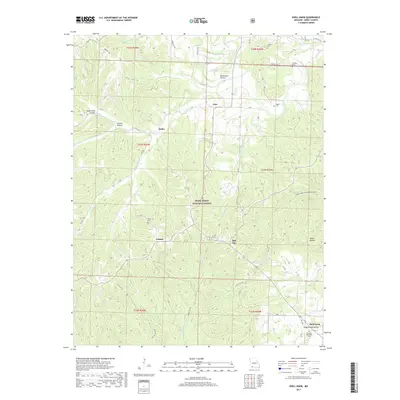
2017 Map of Shell Knob
USGS Topo · Published 2017About this map
Mark Twain National Forest dominates this section of Barry County, Missouri, characterized by a complex network of hollows and creek drainages. Small upland settlements like Cato, Hailey, and Lohmer serve as focal points for the surrounding rural area, connected by a mix of state highways and forest service roads. The map reveals a high density of small family burying grounds, including Pierce Cem and Coones Cem, which are often the only remaining markers of early pioneer homesteads in this terrain. Along the southern edge, the settlement of Shell Knob transitions into the deeper valleys of Ledgerwood Hollow and Big Cr. Outdoor recreation and conservation are primary land uses, evidenced by the Piney Creek Wilderness Trail and numerous forest access points near Williams Br and Flat Creek.
Find a feature on this map
55 named features on this map. Tap any name to fly to it.
Don’t see what you’re looking for? This feature index may not catch every label — zoom into the map to look around manually.
Map Details
Editions of this 2017 Shell Knob Map
This is the sole edition of this map. No revisions or reprints were ever made.
Other maps of this area

1927 · Shell Knob
USGS Topo · 1:62,500

1937 · Cassville
USGS Topo · 1:48,000

1942 · Aurora
USGS Topo · 1:62,500

1943 · Monett
USGS Topo · 1:62,500

1944 · Cassville
USGS Topo · 1:62,500

1945 · Harrison
USGS Topo · 1:250,000

1945 · Aurora
USGS Topo · 1:62,500

1949 · Harrison
USGS Topo · 1:250,000

1950 · Shell Knob
USGS Topo · 1:62,500

1954 · Harrison
USGS Topo · 1:250,000