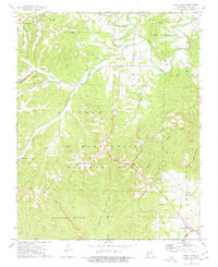
1974 Map of Shell Knob
USGS Topo · Published 1977About this map
The rugged Ozark landscape of Barry County is documented here within the Mark Twain National Forest, showing a network of small settlements and family burial grounds during the mid-1970s. The terrain is defined by deep hollows and high ridges like McDonald Mountain and the prominent Shell Knob. Numerous small communities are scattered across the forest, including Lohmer, Hill City, Hailey, and Cato.
Find a feature on this map
38 named features on this map. Tap any name to fly to it.
Don’t see what you’re looking for? This feature index may not catch every label — zoom into the map to look around manually.
Map Details
Editions of this 1974 Shell Knob Map
2 editions found
Other maps of this area

1927 · Shell Knob
USGS Topo · 1:62,500

1937 · Cassville
USGS Topo · 1:48,000

1942 · Aurora
USGS Topo · 1:62,500

1943 · Monett
USGS Topo · 1:62,500

1944 · Cassville
USGS Topo · 1:62,500

1945 · Harrison
USGS Topo · 1:250,000

1945 · Aurora
USGS Topo · 1:62,500

1949 · Harrison
USGS Topo · 1:250,000

1950 · Shell Knob
USGS Topo · 1:62,500

1954 · Harrison
USGS Topo · 1:250,000