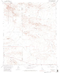
1959 Map of Shell Reef
USGS Topo · Published 1981About this map
Anza-Borrego Desert State Park dominates the western portion of this landscape, where the rugged topography of the Ocotillo Badlands and Squaw Peak meets the arid lowlands of the Imperial Valley. Water, though scarce, defines the geography here, with the San Felipe Creek drainage system and its tributaries like Tarantula Wash and Tule Wash carving deep paths through the desert floor. This 1959 survey provides a precise look at historical water sources and points of interest for early travelers, including the Los Puertecitos Historical Marker and the isolated Wolfe Well (Dry). The distinct geological formations of Shell Reef and the Pumpkin Patch are clearly delineated, illustrating the varied terrain that exists along the San Diego Co Imperial Co boundary. The presence of a Levee near Benson Lake indicates early efforts to manage seasonal flows in this desert environment.
Find a feature on this map
18 named features on this map. Tap any name to fly to it.
Don’t see what you’re looking for? This feature index may not catch every label — zoom into the map to look around manually.
Map Details
Editions of this 1959 Shell Reef Map
3 editions found
Other maps of this area

1904 · Indio
USGS Topo · 1:125,000

1931 · Vallecito
USGS Topo · 1:125,000

1940 · Kane Spring
USGS Topo · 1:62,500

1940 · Durmid
USGS Topo · 1:62,500

1942 · Barrel Spring
USGS Topo · 1:62,500

1942 · Agua Dulce
USGS Topo · 1:62,500

1943 · Vallecito
USGS Topo · 1:125,000

1944 · Agua Dulce
USGS Topo · 1:62,500

1944 · Durmid
USGS Topo · 1:62,500

1944 · Kane Spring
USGS Topo · 1:62,500